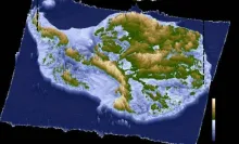
A team of international scientists has produced the most detailed map yet of Antarctica’s subglacial terrain, revealing a vast, previously unseen network of mountains, valleys, and lakes beneath the ice sheet. This unprecedented dataset offers crucial insights into the continent’s geology, ice dynamics, and potential impacts on global sea levels. The high-resolution map combines radar and satellite technology, allowing researchers to understand how subglacial topography influences ice flow and stability.