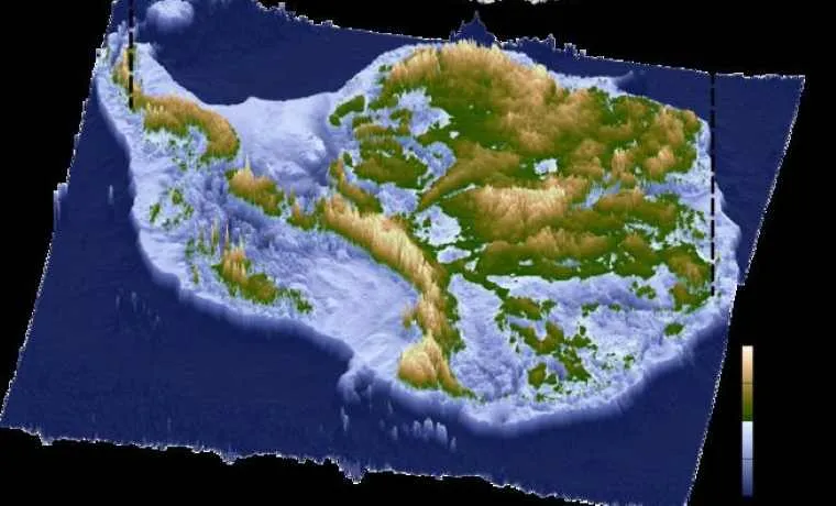
A team of international scientists has produced the most detailed map yet of Antarctica’s subglacial terrain, revealing a vast, previously unseen network of mountains, valleys, and lakes beneath the ice sheet. This unprecedented dataset offers crucial insights into the continent’s geology, ice dynamics, and potential impacts on global sea levels. The high-resolution map combines radar and satellite technology, allowing researchers to understand how subglacial topography influences ice flow and stability. Beyond scientific curiosity, the findings carry significant implications for climate modeling, infrastructure planning in polar regions, and predicting future contributions of Antarctic ice melt to rising seas.
Mapping the Hidden Continent
For decades, Antarctica’s ice sheet has concealed a complex and largely unexplored landscape. Using advanced ice-penetrating radar and satellite observations, researchers have reconstructed the contours of subglacial mountains, valleys, and extensive lake systems. The new map highlights features that were previously only hypothesized, providing a three-dimensional understanding of the terrain beneath thousands of meters of ice.
Implications for Ice Sheet Dynamics
The subglacial topography directly affects the flow of ice across the continent. Deep valleys and subglacial lakes can act as lubricants, accelerating ice movement toward the coast, while elevated ridges may stabilize certain regions. Understanding these dynamics is critical for predicting how Antarctic ice will respond to rising global temperatures and contribute to sea-level change.
Advances in Technology and Collaboration
The achievement stems from integrating multiple datasets, including airborne radar surveys, satellite altimetry, and gravity measurements. International collaboration allowed the team to cover previously inaccessible regions and produce a map of unprecedented resolution. The study exemplifies how technology and global partnerships can unlock insights into remote, high-risk environments.
Climate and Global Significance
Antarctica holds enough ice to raise sea levels by over 60 meters if fully melted. Detailed knowledge of subglacial landscapes enables climate scientists to model ice-sheet behavior more accurately and forecast potential sea-level rise scenarios. Policymakers and coastal planners can use this information to prepare for long-term climate impacts.
Future Research Directions
Beyond ice dynamics, the subglacial map opens avenues for studying hidden ecosystems and ancient geological formations preserved beneath the ice. Scientists anticipate that future exploration may reveal microbial life adapted to extreme conditions, shedding light on Earth’s history and the potential for life in similar extraterrestrial environments.
Comments